
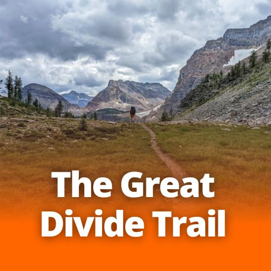
The Great Divide Trail
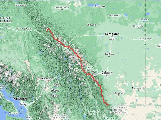
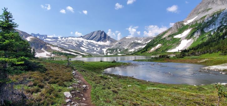
One of the most challenging trails to hike in Canada, the Great Divide traverses the continental divide between Alberta and British Columbia for more than 1100 km! It’s not officially designated, and sometimes it’s not even a trail but a wilderness route much like that of many historical Indigenous people and explorers of the area. You’ll pass hanging glaciers, wildflower meadows, turquoise lakes and more.
The GDT can be explored in different ways depending on how adventurous you want to be and how much time you have. Everything from day hikes to week plus long thru-hikes are possible here.
Remember, this is a backcountry hike and should only be done by experienced and prepared individuals – you should probably leave the kids at home for this one.
(https://greatdividetrail.com/trip-planning-resources/maps/)
The trail has a rich history (which should be expected when it passes through the traditional territories of the Blackfoot Confederacy, Tsuut’ina, Stoney (Ĩyãħé) Nakoda, Cree, Lheidli T’enneh, Ktunaxa, Secwepemc, Sinixt and Métis. It was first recorded in 1966 when the Girl Guides of Canada proposed a trail running the BC-Alberta border and in 1970 the first ever GDT guide was developed. Over the next several decades the trail was more formally developed and distinguished, studied and planned with contributions made from Parks Canada, the Opportunities for Youth (OFY) program (which was federally funded), the Alberta government, and many more.
Despite many set-backs since its inception, today the trail is maintained by The Great Divide Trail Association, who provides a wealth of information and resources to allow you to explore the historical trek!
The 1,130 km trail traverses the Canadian Rockies from Waterton Lakes National Park to Kakwa Provincial Park. It’s made up of established hiking trails and natural, rugged trail paths winding through five national parks, eight provincial parks, three wildland provincial parks, two wilderness areas, two special management areas, and five forest districts! If you’re going out to hike the entire length it can take 8 weeks!
- Section A: Waterton to Coleman, 144 km
- Section B: Coleman to Peter Lougheed Provincial Park, 179 km
- Section C: Peter Lougheed Provincial Park to Field, 201km
- Section D: Field to Saskatchewan Crossing, 105 km
- Section E: Saskatchewan Crossing to Jasper, 188 km
- Section F: Jasper to Mount Robson, 122 km
- Section G: Mount Robson to Kakwa Provincial Park, 160 km
Actually a combination of other trails and not officially a designated hiking trail itself, the GDT is made up of some of Canada’s most popular trails such as the Rockwall Trail in Kootenay National Park and the Skyline in Jasper National Park. Along with these, there are other ‘alternate’ routes throughout that hikers can choose from, making some of those route distances more of an approximation.
If you are going to have a go at even part of this massive journey, make sure you look at weather forecasts and have a planned route. The window for a safe thru-hike only goes from June to mid September (and remember, the whole thing can take 8 weeks!) Look to The Great Divide Association for updates on trail conditions, planning resources, permit information, and more. https://greatdividetrail.com/(information from The Great Divide Trail Association)